Data Stores
Data Stores are the heart of the Stratos Geospatial Platform. The underlying mechanism is a relational database system (MySQL/MariaDB) that manages the user's geospatial data layers. We add lots of clever bits that enable functionality like coordinate system support, map tiling, and additional meta-data to drive the downstream APIs. All interaction with the database is through the dashboard, APIs and command line tools. directly manipulating the database, unless under the instruction of technical support, is discouraged, and could cause data corruption.
When a Data Store is created, a full quite of Open Geospatial Consortium(OGC)-compliant API endpoints, as well as REST and Python administration APIs are automatically created and linked to the Data Store. So management of published web service content consists of editing the data layers available in a Data Store, and the platform takes care of the rest.
Creating a New Data Store
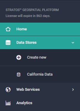
To create a Data Store, open the Data Stores menu in the left sidebar and click the "Create new" button.
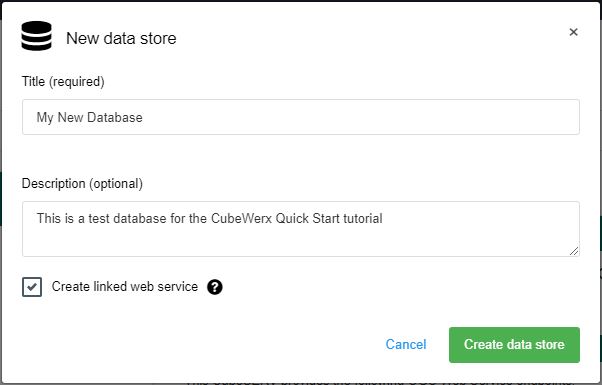
Fill in the dialog that appears. Only the title field is required. Leave the "Create linked web service" checkbox checked. Then click "Create data store". It is possible to create non-linked Data Stores by leaving the checkbox unticked. You may want to do this if you are building a more complex set of data layers, broken into multiple Data Stores, planning to merge them at the web services layer later.
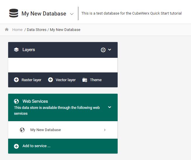
You'll see your new (empty) Data Store in the main screen area. The two panels shown here let you manage the layers in your new data store and decide what web services you want them made available to. Notice that Stratos has already created a new web service with the same name as your Data Store.
Deleting a Data Store or Editing metadata
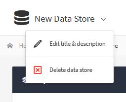
The menu for deleting a Data Store or editing its title and description is located in the dropdown menu attached to the Data Store's title on its homepage.
Warning - Deleting Data Stores
Deleting a Data Store will delete all the vector data that has been loaded into it as well any raster imagery that has been uploaded directly through the dashboard. All map tiles and available web service layers will be removed. Raster imagery that has been loaded by reference from NAS or cloud object storage will be de-registered from the associated data layer, but not deleted from storage.
Programatically
Add or Edit a Data Store https://dev.cubewerx.com/~gstowe/cubewerx/cubeserv/default/admin/api#/CubeSTOR%20Databases/put_admin_cubestors__dbName_
https://www.cubewerx.com/documentation/9.7/pythonApi/stratos.html#Stratos.addCubeSTOR
TBD